Digital Commonwealth — Boston Public Library
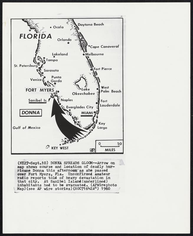
Donna Spreads Gloom -- Arrow on map shows course and location of deadly hurricane Donna this afternoon as she passed over Fort Myers, Fla. Unconfirmed amateur radio reports told of heavy devastation in that city. At Sanibel Island (underlined) inhabitants had to be evacuated.
Associated Press · [ca. September 1960]
[Information from item housing] Weather: Hurricane: Maps: Wire Photos
🔒
Order museum-quality prints
Sign in to order prints, canvas, and more of this work. Browsing and full-resolution downloads stay free.