Digital Commonwealth — American Antiquarian Society
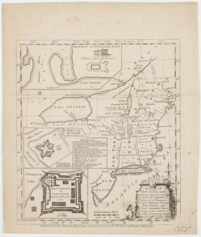
A Map of New England & ye country adjacent,
Farwell, John Whittemore, 1843-1929 · 1755
Subject: Map of New England and New York state, with three inset plans of European forts.
🔒
Order museum-quality prints
Sign in to order prints, canvas, and more of this work. Browsing and full-resolution downloads stay free.