Digital Commonwealth — American Antiquarian Society
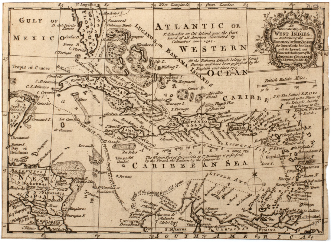
An accurate map of the West Indies,
Bowen, Emanuel, -1767 · [1758]
Subject: Map of the Caribbean Islands, with a portion of Florida and Central America seen.
🔒
Order museum-quality prints
Sign in to order prints, canvas, and more of this work. Browsing and full-resolution downloads stay free.