Digital Commonwealth — Boston Public Library
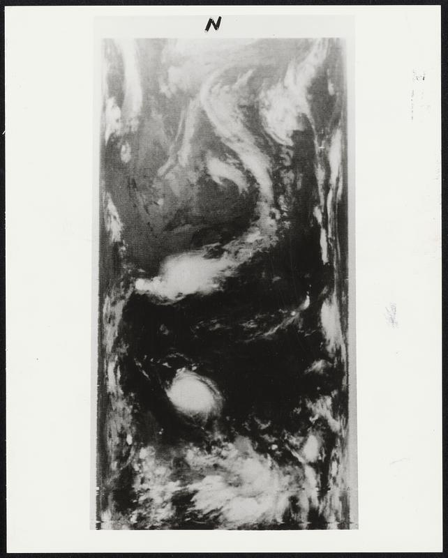
Space Photo of Hurricane Celia.--In total darkness and some 900 miles in space. NASA's Improved TIROS Operational Satellite - 1 (ITOS-1) snapped this infrared photo of Hurricane Celia (circular white mass, lower center) at 4:30 a.m. EDT, August 3, 1970, when the storm was about 200 miles East, southeast of Corpus Christi Texas. Other land marks are the Great Lakes (upper center) and the Eastern Seaboard (right, center). Long white mass extending from Canada into the Midwest is the frontal system which passed through the Washington, D.C., area last evening (August 3, 1970).
United States. National Aeronautics and Space Administration · [ca. August 1970]
[Information from item housing] Weather: Hurricane: Misc.
🔒
Order museum-quality prints
Sign in to order prints, canvas, and more of this work. Browsing and full-resolution downloads stay free.