Digital Commonwealth — Boston Public Library
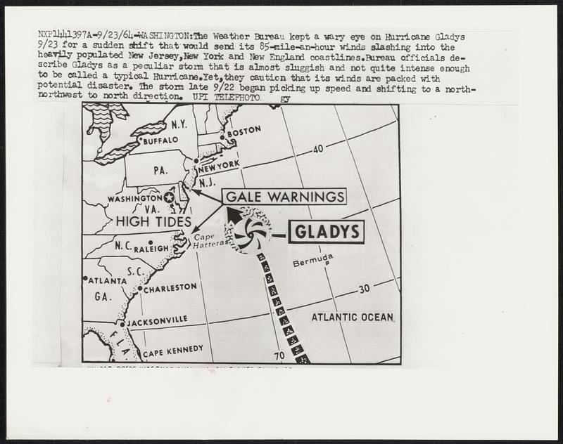
The Weather Bureau kept a wary eye on Hurricane Gladys 9/23 for a sudden shift that would send its 85-mile-an-hour winds slashing into the heavily populated New Jersey, New York and New England coastlines. Bureau officials describe Gladys as a peculiar storm that is almost sluggish and not quite intense enough to be called a typical Hurricane. Yet, they caution that its winds are packed with potential disaster. The storm late 9/22 began picking up speed and shifting to a north-northwest to north direction.
United Press International · [ca. September 1964]
[Information from item housing] Weather: Hurricane: Maps: Wire Photos
🔒
Order museum-quality prints
Sign in to order prints, canvas, and more of this work. Browsing and full-resolution downloads stay free.