Digital Commonwealth — Boston Public Library
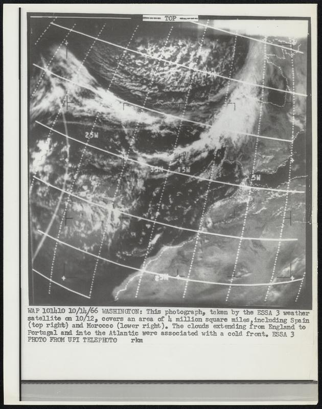
Washington: This photograph, taken by the ESSA 3 weather satellite on 10/12, covers an area of 4 million square miles, including Spain (top right) and Morocco (lower right). the clouds extending from England to Portugal and into the Atlantic were associated with a cold front. Essa.
United Press International · [ca. October 1966]
[Information from item housing] Weather: Misc: Wire Photos
🔒
Order museum-quality prints
Sign in to order prints, canvas, and more of this work. Browsing and full-resolution downloads stay free.