Digital Commonwealth — Boston Public Library
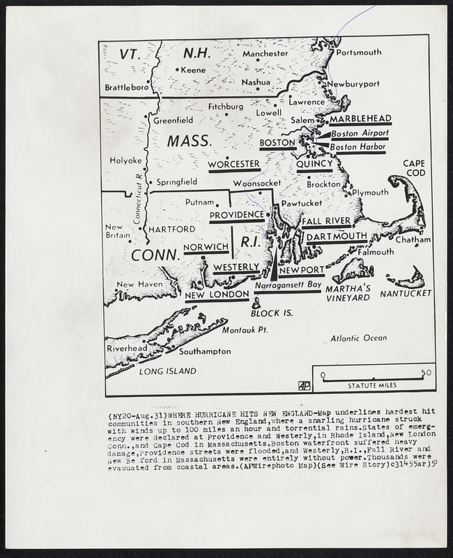
Where Hurricane Hits New England-Map underlines hardest hit communities in southern New England, where a snarling hurricane struck with winds up to 100 miles an hour and torrential rains. States of emergency were declared at Providence and Westerly, in Rhode Island, New London Conn., and Cape Cod in Massachusetts. Boston waterfront suffered heavy damage, Providence streets were flooded, and Westerly, R.I., Fall River and New Bedford in Massachusetts were entirely without power. Thousands were evacuated from coastal areas.
Associated Press · [ca. August 1951]
[Information from item housing] Weather: Hurricane: Maps: Wire Photos
🔒
Order museum-quality prints
Sign in to order prints, canvas, and more of this work. Browsing and full-resolution downloads stay free.