Digital Commonwealth — Boston Public Library
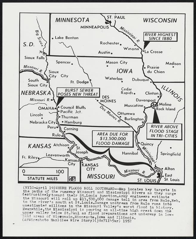
Where Floods Roll Southward--Map locates key targets in the paths of the runaway Missouri and Mississippi Rivers as they surge destructively toward their St. Louis junction. Army engineers estimate the Missouri will roll up $13,500,000 damage toll in area from Rulo, Neb. to the river's mouth at St. Louis. Damage upstream from Rulo runs into unestimated millions in the Missouri Valley's worst flood in history. Meanwhile, the Mississippi is pouring an all-time high crest down the upper valley below St. Paul as flood preparations are underway in lowland areas of Wisconsin, Minnesota, Iowa and Illinois.
Associated Press · [ca. April 1952]
[Information from item housing] Floods: 1952: Wire Photos
🔒
Order museum-quality prints
Sign in to order prints, canvas, and more of this work. Browsing and full-resolution downloads stay free.