Digital Commonwealth — Boston Public Library
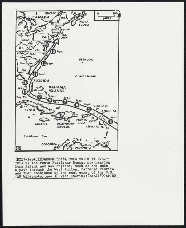
Where Donna Took Swipe At U.S. -- This is the route Hurricane Donna, now nearing Los Island and New England, took as she made a path through the West Indies, battered Florida and then continued up the east coast of the U.S.
Associated Press · [ca. September 1960]
[Information from item housing] Weather: Hurricane: Maps: Wire Photos
🔒
Order museum-quality prints
Sign in to order prints, canvas, and more of this work. Browsing and full-resolution downloads stay free.