Digital Commonwealth — Boston Public Library
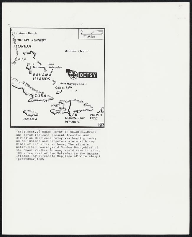
Where Betsy Is Heading -- Cross and arrow indicate present location and direction Hurricane Betsy was heading today as an intense and dangerous storm with top winds of 125 miles an hour. The storm’s anticipated course, said Gordon Dunn, chief of the Miami Weather Bureau, would take it about 100 miles east of San Salvador in the Bahama Islands.
Associated Press · [ca. September 1965]
[Information from item housing] Weather: Hurricane: Maps: Wire Photos
🔒
Order museum-quality prints
Sign in to order prints, canvas, and more of this work. Browsing and full-resolution downloads stay free.