Digital Commonwealth — Boston Public Library
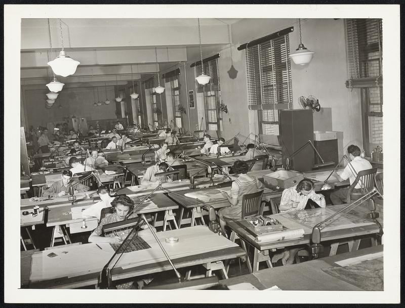
War Charts. The demand by the Armed Forces for aeronautical and nautical charts was caused a seven-fold expansion in the U.S. Government Coast and Geodetic Survey. The personnel engaged in chart construction has swelled from 200 in 1940, to 316 in 1941, and to more than 1000 in 1942. What was formerly confined to one office, chart making is now being done in seven widely separated places in a decentralizing setup. Another feature of the expansion has been the replacement of men by girls. They are replacing men as rapidly as they can be trained in special courses offered by a large number of colleges and universities. This is a general view of one of the drafting rooms. In this room final drawings for charts are made.
Wide World Photos, Inc. · [ca. July 1942]
[Information from item housing] Maps & Mapmaking
🔒
Order museum-quality prints
Sign in to order prints, canvas, and more of this work. Browsing and full-resolution downloads stay free.