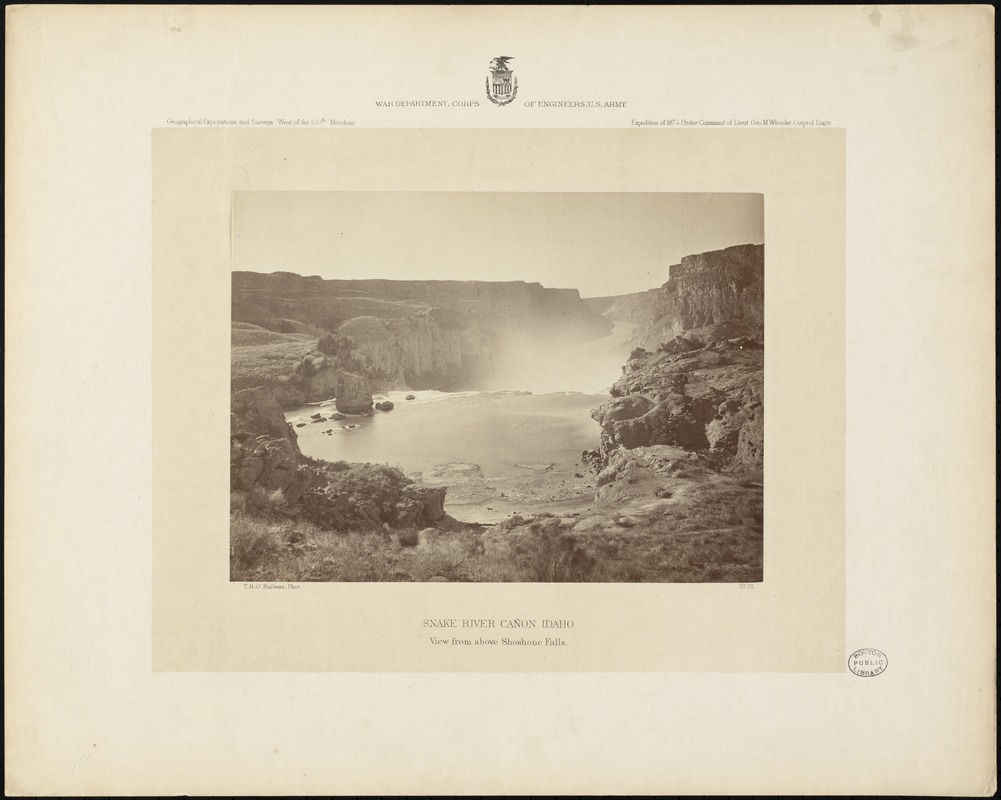
Snake River Cañon, Idaho, view from above Shoshone Falls
O'Sullivan, Timothy H., 1840-1882 · [1874]
Descriptive legend of view no. 25: Looking down stream from this point the cañon is visible for a stretch of five miles. The general direction of Snake River is northwest, until its distant junction with the Columbia. Its cañon is cut through a volcanic plateau 600 miles in extent, which is known as Salmon River Plains. Now that this district has been freed from the terror of hostile Indians, it is being extensively utilized as a pasturage for sheep and cattle, and in the neighboring mountains, 30 miles from Shoshone Falls there is an abundance of game for the hunter. At Little Falls, a small colony of Chinamen are engaged in washing gold from the sands of the river, and at Shoshone Falls also; on the beach of the cove which is represented in the immediate foreground of the picture there are good diggings. These, being exhausted, are renewed again by the agency of the river, which, entering the scene from the right, circles around this tranquil bay and deposits that precious sediment which it has washed from some unknown placers above. Near the left side of the stream, just above the falls, stands Eagle Rock, an isolated bowlder 60 feet high, on whose summit an eagle has established its home and built its nest, interweaving the branches of trees into a basket for the protection of its young.
Sign in to order prints, canvas, and more of this work. Browsing and full-resolution downloads stay free.