Digital Commonwealth — Boston Public Library
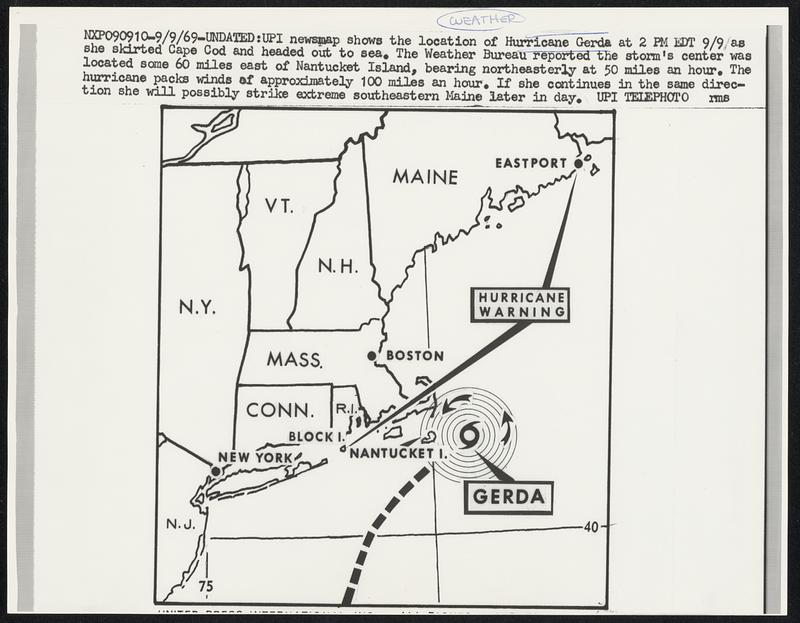
UPI newsmap shows the location of Hurricane Gerda at 2 PM EDT 9/9 as she skirted Cape Cod and headed out to sea. The Weather Bureau reported the storm’s center was located some 60 miles east of Nantucket Island, bearing northeasterly at 50 miles an hour. The hurricane packs winds of approximately 100 miles an hour. If she continues in the same direction she will possibly strike extreme southeastern Maine later in day.
United Press International · [ca. September 1969]
[Information from item housing] Weather: Hurricane: Gerda, Sept 1969: Wire Photos
🔒
Order museum-quality prints
Sign in to order prints, canvas, and more of this work. Browsing and full-resolution downloads stay free.