Digital Commonwealth — Boston Public Library
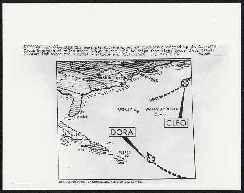
The season's first and second hurricanes whipped up the Atlantic Ocean hundreds of miles apart 9/4, a threat only to ships that might cross their paths. Newsmap indicates the storms' positions and directions.
United Press International · [ca. September 1964]
[Information from item housing] Weather: Hurricane: Maps: Wire Photos
🔒
Order museum-quality prints
Sign in to order prints, canvas, and more of this work. Browsing and full-resolution downloads stay free.