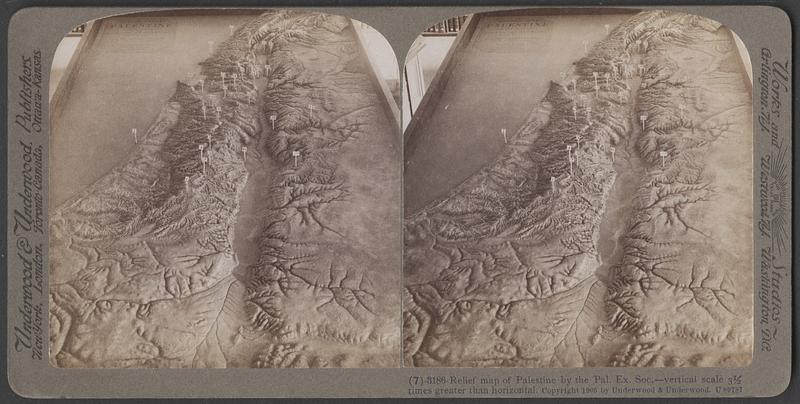
Relief map of Palestine
Underwood & Underwood · (c) 1905
The map we see here was modeled from charts prepared by the Palestine Exploration Society, but in order to render important points easily distinguishable, the vertical scale was made three and a half times as great as the horizontal scale. The numbered markers identify the following-named places: - 1. Hebron 2. Bethlehem. 3. Jerusalem. 4. Mizpah. 5. Bethel. 6. Jericho. 7. Joppa. 8. Ebal and Gerizim. 9. Samaria. 10. Dothan. 11. Esdraelon (Plain of). 12. Gilboa, Mountains of (at Jezreel). 13. Bethshan. 14. Mt. Tabor. 15. Nazareth. 16. Carmel (Elisha's Altar). 17. Tiberias. 18. Mt. Beatitudes. 19. Capernaum. 20. Bethsaida Julius. 21. Tyre. 22. Sidon. 23. Dan. 24. Caesarea Philippi. 25. Mt. Hermon. 26. Damascus. 27. Jerash. 28. Jahbok. 29. Nebo (Moab Range). From the Travel Lessons on the Life of Jesus and Travel Lessons on the Old Testament by William Byron Forubsh, Ph.D., published by Underwood & Underwood.
Sign in to order prints, canvas, and more of this work. Browsing and full-resolution downloads stay free.