Digital Commonwealth — Boston Public Library
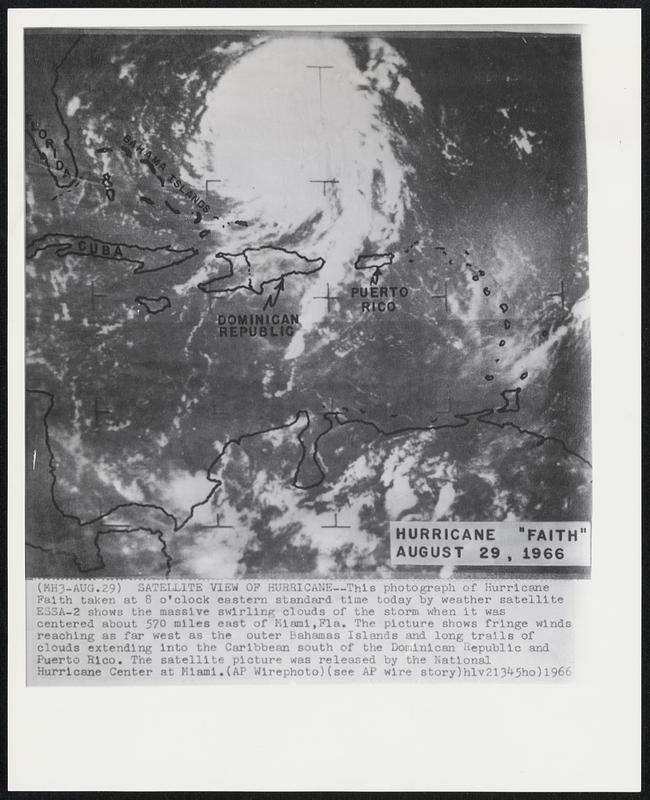
Satellite View of Hurricane--This photograph of Hurricane Faith taken at 8 o'clock eastern standard time today by weather satellite ESSA-2 shows the massive swirling clouds of the storm when it was centered about 570 miles east of Miami, Fla. The picture shows fringe winds reaching as far west as the outer Bahamas Islands and long trails of clouds extending into the Caribbean south of the Dominican Republic and Puerto Rico. The satellite picture was released by the National Hurricane Center at Miami.
Associated Press · [ca. August 1966]
[Information from item housing] Weather: Hurricane: Misc: Wire Photos
🔒
Order museum-quality prints
Sign in to order prints, canvas, and more of this work. Browsing and full-resolution downloads stay free.