Digital Commonwealth — Boston Public Library
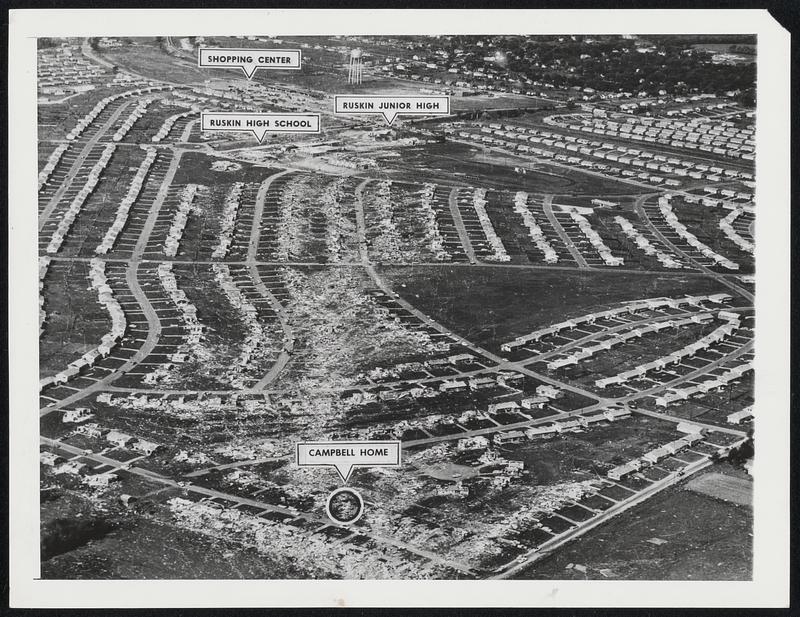
Ruskin Heights: Then The tornado's path of destruction through the residential heart of Ruskin Heights, Mo., is easily traced in this aerial photograph taken May 21, 1957, the day after the storm struck. "Ruskin Heights could have been framed and labeled 'Desolation,'" says Mrs. Earl F. Campbell, who rode out the storm in a cellar while her home was demolished. The twister rang up a death toll of 47 and destroyed 483 homes as well as Ruskin Senior and Junior High Schools and the area's shopping area.
Associated Press · [ca. June 1958]
[Information from item housing] Weather: Tornados: 1950s: Wire Photos
🔒
Order museum-quality prints
Sign in to order prints, canvas, and more of this work. Browsing and full-resolution downloads stay free.