Digital Commonwealth — Boston Public Library
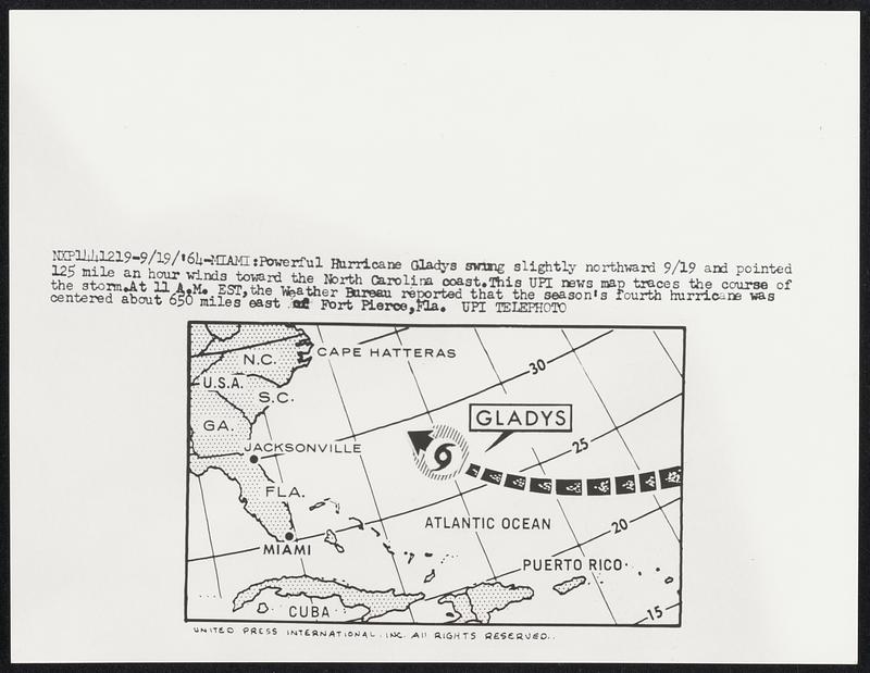
Powerful Hurricane Gladys swing slightly northward 9/19 and pointed and pointed 125 mile an hour winds toward the North Carolina coast. This UPI news map traces the course of the storm. At 11 A.M. EST, the Weather Bureau reported that the season’s fourth hurricane was centered about 650 miles east of Fort Pierce, Fla.
United Press International · [ca. September 1964]
[Information from item housing] Weather: Hurricane: Maps: Wire Photos
🔒
Order museum-quality prints
Sign in to order prints, canvas, and more of this work. Browsing and full-resolution downloads stay free.