Digital Commonwealth — Boston Public Library
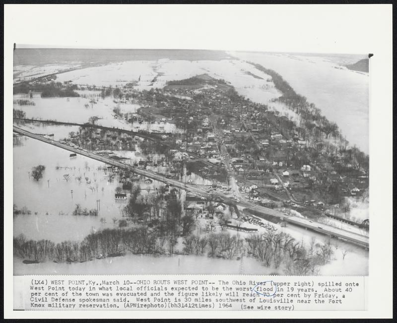
Ohio Routs West Point-- The Ohio River (upper right) spilled onto West Point today in what local officials expected to be the worst flood in 19 years. About 40 per cent of the town was evacuated and the figure likely will reach 70 per cent by Friday, a Civil Defense spokesman said. West Point is 30 miles southwest of Louisville near the Fort Knox military reservation.
Associated Press · [ca. March 1964]
[Information from item housing] Floods: 1964: Wire Photos
🔒
Order museum-quality prints
Sign in to order prints, canvas, and more of this work. Browsing and full-resolution downloads stay free.