Digital Commonwealth — Boston Public Library
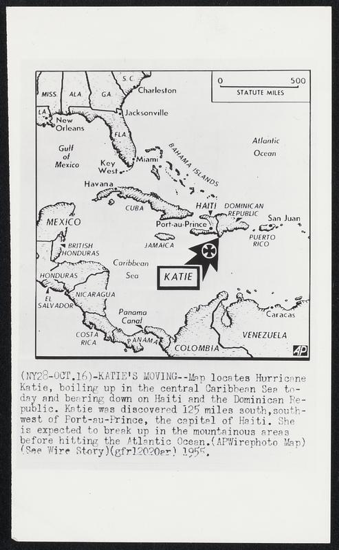
Katie's Moving- -Map locates Hurricane Katie, boiling up in the central Caribbean Sea today and bearing down on Haiti and the Dominican Re-public. Katie was discovered 125 miles south, southwest of Port-au-Prince, the capital of Haiti. She is expected to break up in the mountainous areas before hitting the Atlantic Ocean.
Associated Press · [ca. October 1955]
[Information from item housing] Weather: Hurricane: Maps: Wire Photos
🔒
Order museum-quality prints
Sign in to order prints, canvas, and more of this work. Browsing and full-resolution downloads stay free.