Digital Commonwealth — Boston Public Library
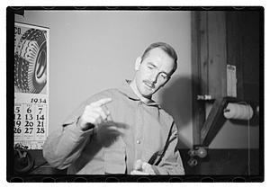
Making the "negative". An operator tacks the contour map to a sheet of cardboard and starts by cutting out the highest contour sections with a special jig-saw that cuts in all directions. The first cardboard will contain only a few holes, representing mountain tops. The contour map is then tacked to another cardboard and the next contour level cut our. When all the cardboards are piled together they form a reverse upside-down model of the section
Fay Foto Service (Boston, Mass.) · [ca. June 1938]
[Information from item housing] Map & Mapmaking
🔒
Order museum-quality prints
Sign in to order prints, canvas, and more of this work. Browsing and full-resolution downloads stay free.