Digital Commonwealth — Boston Public Library
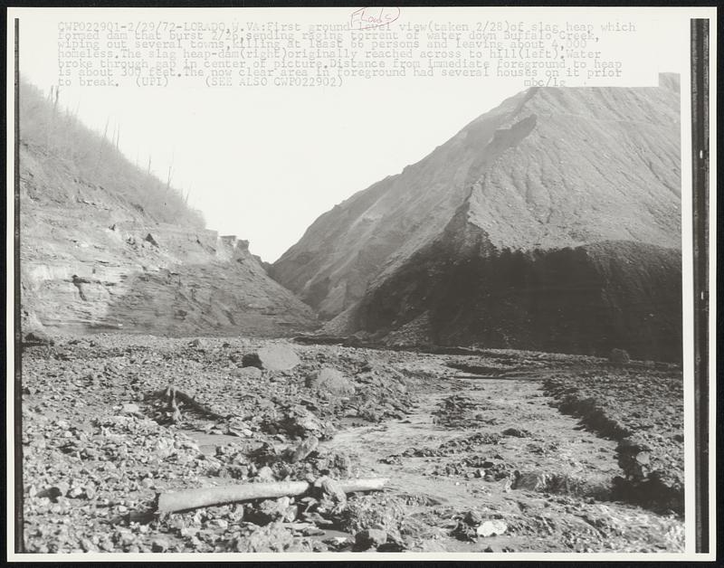
Lorado, W. VA: First ground level view (taken 2/28) of slag heap which formed dam that burst 2/26, sending raging torrent of water down Buffalo Creek, wiping out several towns, killing at least 66 persons and leaving about 4,000 homeless. The slag heap-dam (right) originally reached across to hill (left). Water broke through gap in center of picture. Distance from immediate foreground to heap is about 300 feet. The now clear are in foreground had several houses on it prior to break.
United Press International · [ca. February 1972]
[Information from item housing] Floods: 1970s
🔒
Order museum-quality prints
Sign in to order prints, canvas, and more of this work. Browsing and full-resolution downloads stay free.