Digital Commonwealth — Boston Public Library
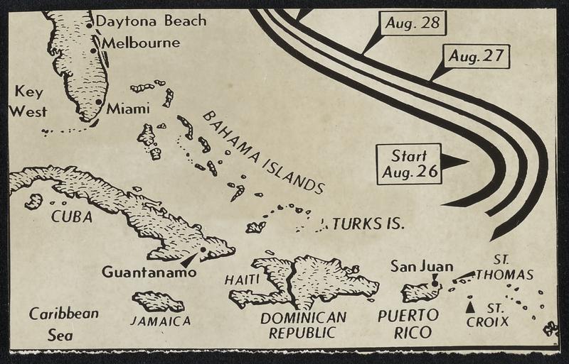
Hurricane Nears Cape Hatteras-- Map traces course of hurricane, the center of which the weather bureau predicts will pass over or near Cape Hatteras today. From an emergency center in Morehead City, the Red Cross last night ordered 1000 persons to quit Atlantic Beach. Hurricane warnings (black) were displayed along North Carolina coast while storm warnings (shaded) were flying as far north as the Virginia capes.
Associated Press · [ca. 1908–1972]
[Information from item housing] Weather: Hurricane: Maps: Wire Photos
🔒
Order museum-quality prints
Sign in to order prints, canvas, and more of this work. Browsing and full-resolution downloads stay free.