Digital Commonwealth — Boston Public Library
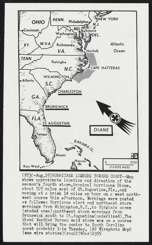
Hurricane Lumbers Toward Coast -- Map shows approximate location and direction of the season's fourth storm, tropical hurricane Diane, about 525 miles east of St. Augustine, Fla., and moving at a brisk 14 miles an hour on a west north-west course this afternoon. Warnings were posted as follows: Hurricane alert and northern storm warnings from Washington, N.C., to Virginia capes (shaded area); northwest storm warnings from Brunswick south to St. Augustine (underlined). The Miami Weather Bureau said storm was on a course that will bring the center to South Carolina coast probably late Tuesday.
Associated Press · [ca. August 1955]
[Information from item housing] Weather: Hurricane: Diane, Aug. 1955: Wirephotos
🔒
Order museum-quality prints
Sign in to order prints, canvas, and more of this work. Browsing and full-resolution downloads stay free.