Digital Commonwealth — Boston Public Library
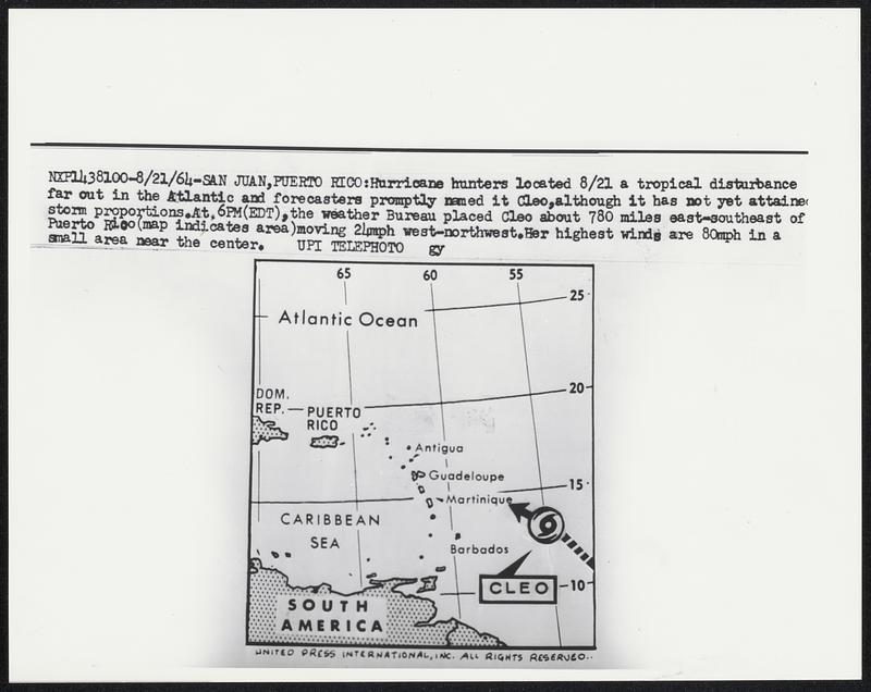
Hurricane hunters located 8/21 a tropical disturbance far out in the Atlantic and forecasters promptly named it Cleo, although it has not yet attained storm proportions. At 6PM (EDT), the weather Bureau placed Cleo about 780 miles east-southeast of Puerto Rico (map indicated area) moving 21mph west-northwest. Her highest winds are 80mph in a small area near the center.
United Press International · [ca. August 1964]
[Information from item housing] Weather: Hurricane: Maps: Wire Photos
🔒
Order museum-quality prints
Sign in to order prints, canvas, and more of this work. Browsing and full-resolution downloads stay free.