Digital Commonwealth — Boston Public Library
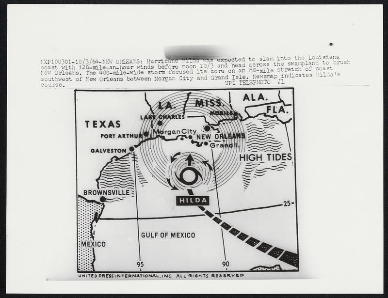
Hurricane Hilda was expected to slam into the Louisiana coast with 120-mile-an-hour winds before noon 10/3 and head across the swampland to brush New Orleans. The 400-mile-wide storm focused its core on an 80-mile stretch of coast southwest of New Orleans between Morgan City and Grand Isle. Newsmap indicates Hilda’s course.
United Press International · [ca. October 1964]
[Information from item housing] Weather: Hurricane: Maps: Wire Photos
🔒
Order museum-quality prints
Sign in to order prints, canvas, and more of this work. Browsing and full-resolution downloads stay free.
![James [Jim] Amos, Barbara [Lorraine Greene]](https://bpldcassets.blob.core.windows.net/derivatives/images/commonwealth:fj237g831/image_thumbnail_300.jpg)