Digital Commonwealth — Boston Public Library
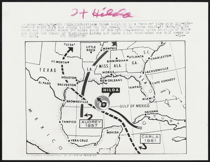
Hurricane Hilda built up to a “severe” blow with 125-mile-an-hour winds 10/1 and slowly headed for the low-lying Louisiana coast. At noon, EDT, the storm was centered about 350 miles south of New Orleans. Newsmap spots location of Hilda and shows the tracks of Hurricanes Audrey and Carle which devastated the Gulf areas in the past.
United Press International · [ca. October 1964]
[Information from item housing] Weather: Hurricane: Maps: Wire Photos
🔒
Order museum-quality prints
Sign in to order prints, canvas, and more of this work. Browsing and full-resolution downloads stay free.