Digital Commonwealth — Boston Public Library
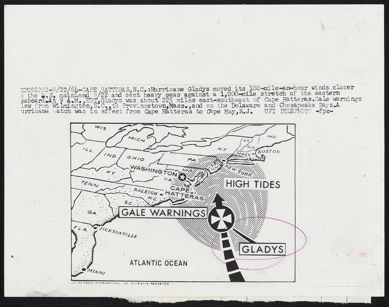
Hurricane Gladys moved its 100-mile-an-hour winds closer to the U.S. mainland 9/22 and sent heavy seas against a 1,000-mile stretch of the eastern seaboard. At 9 A.M., EDT, Gladys was about 225 miles east-southeast of Cape Hatteras. Gale warnings flew from Wilmington, N.C., to Provincetown, Mass., and on the Delaware and Chesapeake Bays. A hurricane watch was in the effect from Cape Hatteras to Cape May, N.J.
United Press International · [ca. September 1964]
[Information from item housing] Weather: Hurricane: Gladys, Sept. 1964
🔒
Order museum-quality prints
Sign in to order prints, canvas, and more of this work. Browsing and full-resolution downloads stay free.