Digital Commonwealth — Boston Public Library
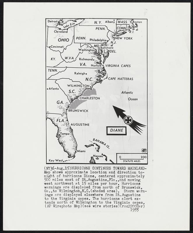
Hurricane continues Toward Mainland -- Map shows approximate location and direction tonight of hurricane Diane, centered approximately 500 miles east of St. Augustine, Fla., and moving west northwest at 15 miles per hour. Hurricane warnings are displayed from north of Brunswick, Ga., to Wilmington, N.C. (shaded area). Storm warnings are displayed elsewhere from St. Augustine to the Virginia capes. The hurricane alert extends north of Wilmington to the Virginia capes.
Associated Press · [ca. August 1955]
[Information from item housing] Weather: Hurricane: Diane, Aug. 1955: Wirephotos
🔒
Order museum-quality prints
Sign in to order prints, canvas, and more of this work. Browsing and full-resolution downloads stay free.