Digital Commonwealth — Boston Public Library
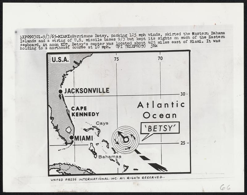
Hurricane Betsy, packing 125 mph winds, skirted the eastern Bahama Islands and a string of U.S. missile bases 9/3 but kept its sight on much of the Eastern seaboard. At noon EDT, Betsy's center was located about 425 miles east of Miami. It was holding to a northeast course at 10 mph.
United Press International · [ca. September 1965]
[Information from item housing] Weather: Hurricane: Maps: Wire Photos
🔒
Order museum-quality prints
Sign in to order prints, canvas, and more of this work. Browsing and full-resolution downloads stay free.