Digital Commonwealth — Boston Public Library
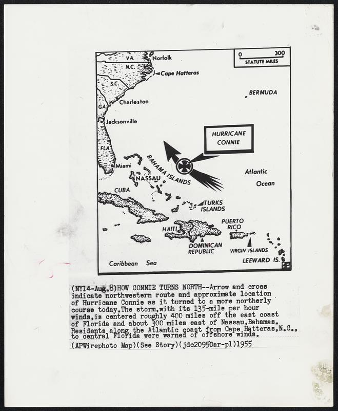
How Connie Turns North--Arrow and cross indicate northwestern route and approximate location of Hurricane Connie as it turned to a more northerly course today. The storm, with its 135-mile per hour winds, is centered roughly 400 miles off the east coast of Florida and about 300 miles east of Nassau, Bahamas. Residents along the Atlantic coast from Cape Hatteras, N.C., to central Florida were warned of offshore winds.
Associated Press · [ca. August 1955]
[Information from item housing] Weather: Hurricane: Maps: Wire Photos
🔒
Order museum-quality prints
Sign in to order prints, canvas, and more of this work. Browsing and full-resolution downloads stay free.