Digital Commonwealth — Boston Public Library
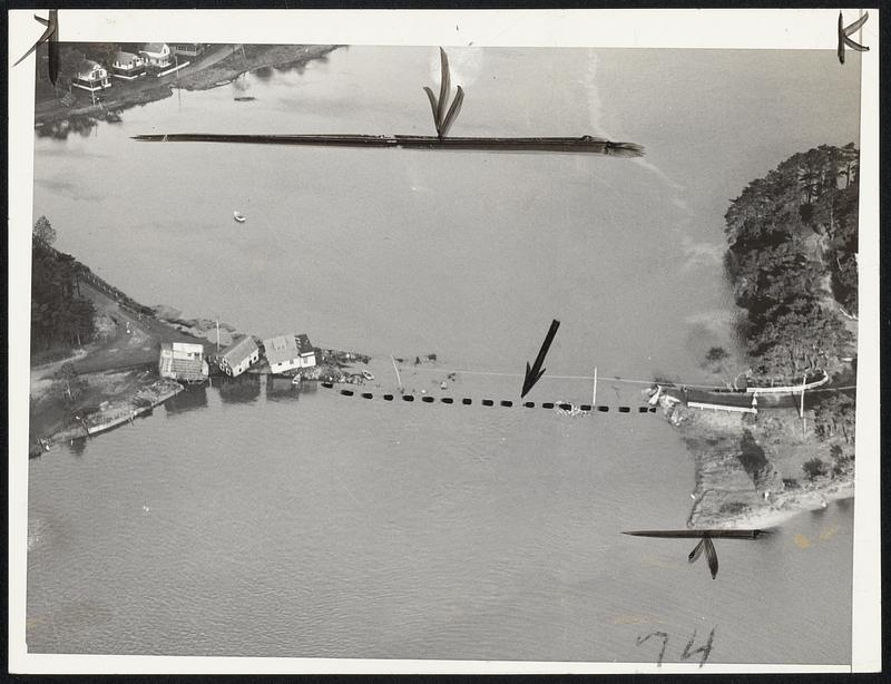
Houses toppled from their foundations into the sea at onset, and a highway became submerged by a "tidal wave in the hurricane today. Dotted line shows where ere highway is located, near the gateway to Cape Cod
Stier, Herbert · [ca. September 1938]
[Information from item housing] Weather: Hurricane: Sept.21&22, 1938
🔒
Order museum-quality prints
Sign in to order prints, canvas, and more of this work. Browsing and full-resolution downloads stay free.