Digital Commonwealth — Boston Public Library
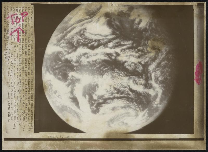
From 23,000 Miles Up-- The National Space and Aeronautics administration released this picture in Washington today and said it is the first to show almost the entire disc of the earth taken from a recently-launched satellite. NASA said this photo was taken 23,000 miles above the equator over the Pacific Ocean yesterday (Dec. 9). Seventy per cent of the picture covers the eastern Pacific and shows storm systems in that area. Nasa said the southern portion of North America, and Central America is in the relatively cloud free are at upper center, with the coast of Chile at lower right.
Associated Press · [ca. December 1966]
[Information from item housing] Earth
🔒
Order museum-quality prints
Sign in to order prints, canvas, and more of this work. Browsing and full-resolution downloads stay free.