Digital Commonwealth — Boston Public Library
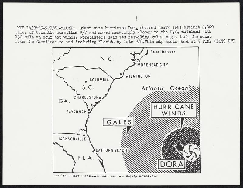
Giant size hurricane Dora churned heavy seas against 2,000 miles of Atlantic coastline 9/7 and moved menacingly closer to the U.S. mainland with 130 mile an hour top winds. Forecasters said its far-flung gales might lash the coast from the Carolinas to and including Florida by late 9/8. This map spots Dora at 5 P.M. (EST)
United Press International · [ca. September 1964]
[Information from item housing] Weather: Hurricane: Maps: Wire Photos
🔒
Order museum-quality prints
Sign in to order prints, canvas, and more of this work. Browsing and full-resolution downloads stay free.