Digital Commonwealth — Boston Public Library
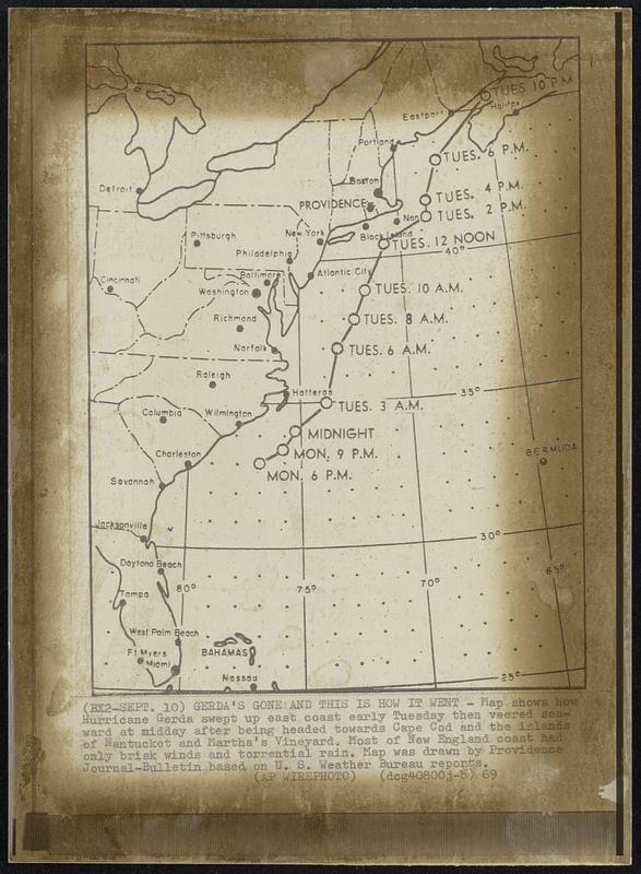
Gerda’s Gone and This Is How It Went - Map shows how Hurricane Gerda swept up east coast early Tuesday then veered seaward at midday after being headed towards Cape Cod and the islands of Nantucket and Martha’s Vineyard. Most of New England coast had only brisk winds and torrential rain. Map was drawn by Providence Journal-Bulletin based on U. S. Weather Bureau reports.
Associated Press · [ca. September 1969]
[Information from item housing] Weather: Hurricane: Gerda, Sept 1969: Wire Photos
🔒
Order museum-quality prints
Sign in to order prints, canvas, and more of this work. Browsing and full-resolution downloads stay free.