Digital Commonwealth — Boston Public Library
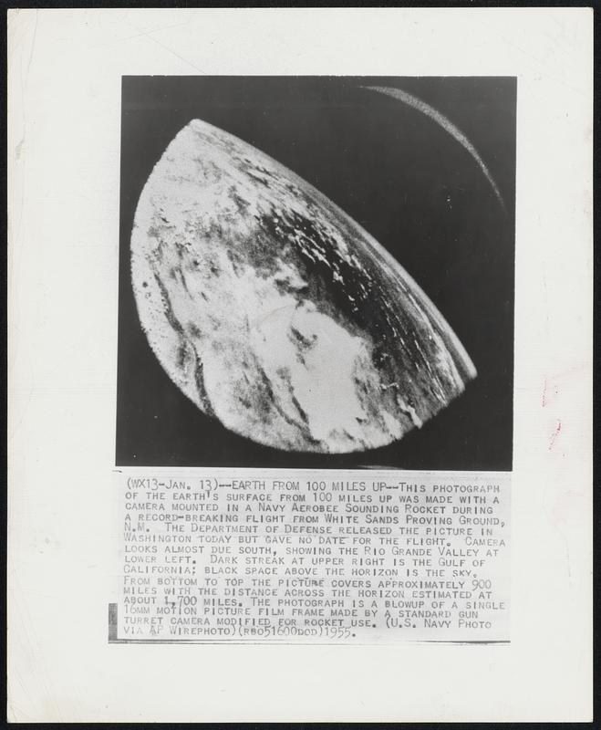
Earth From 100 Miles Up--This photograph of the earth's surface from 100 miles up was made with a camera mounted in a Navy Aerobee Sounding Rocket during a record-breaking flight from White Sands Proving Ground, N.M. The Department of Defense released the picture in Washington today but gave no date for the flight. Camera looks almost due south, showing the Rio Grande Valley at lower left. Dark streak at upper right is the Gulf of California; black space above the horizon is the sky. From bottom to top the picture covers approximately 900 miles with the distance across the horizon estimated at about 1,700 miles. The photograph is a blowup of a single 16mm motion picture film framed made by a standard gun turret camera modified for rocket use.
Associated Press · [ca. January 1955]
[Information from item housing] Earth
🔒
Order museum-quality prints
Sign in to order prints, canvas, and more of this work. Browsing and full-resolution downloads stay free.