Digital Commonwealth — Boston Public Library
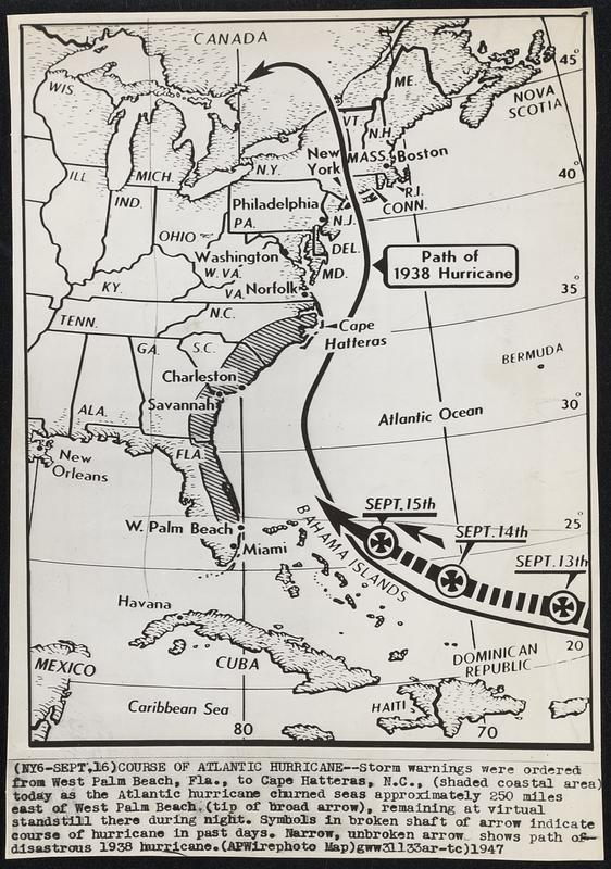
Course of Atlantic Hurricane--Storm warning were ordered from West Palm Beach, Fla., to Cape Hatteras, N.C., (shaded coastal area) today as the Atlantic hurricane churned seas approximately 250 miles east of West Palm Beach (tip of broad arrow), remaining at virtual standstill there during night. Symbols in broken shaft of arrow indicate course of hurricane in past days. Narrow, unbroken arrow shows path of disastrous 1938 hurricane.
Associated Press · [ca. September 1947]
[Information from item housing] Weather: Hurricane: Sept.21&22, 1938
🔒
Order museum-quality prints
Sign in to order prints, canvas, and more of this work. Browsing and full-resolution downloads stay free.