Digital Commonwealth — Boston Public Library
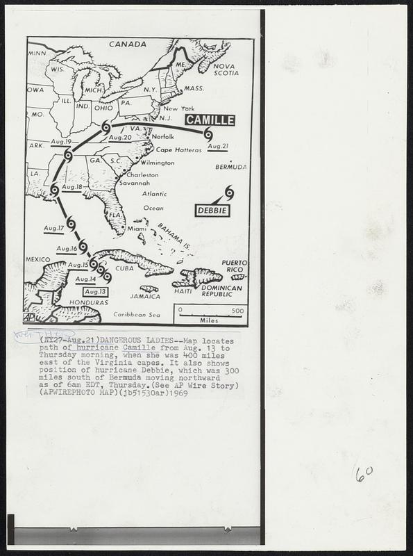
Dangerous Ladies -- Map locates path of hurricane Camille from Aug. 13 to Thursday morning, when she was 400 miles east of the Virginia capes. It also shows position of hurricane Debbie, which was 300 miles south of Bermuda moving northward as of 6am EDT, Thursday. Weather.
Associated Press · [ca. August 1969]
[Information from item housing] Weather: Hurricane: Camille, Aug. 1969: Wire Photos
🔒
Order museum-quality prints
Sign in to order prints, canvas, and more of this work. Browsing and full-resolution downloads stay free.