Digital Commonwealth — Boston Public Library
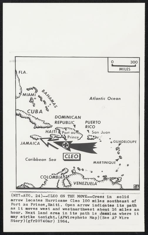
Cleo on the Move--Cross in solid arrow locates Hurricane Cleo 100 miles southeast of Port Au Prince, Haiti. Open arrow indicates its path as it moves west and west-northwest about 16 miles an hour. Next land area in its path is Jamaica where it may strike tonight.
Associated Press · [ca. August 1964]
[Information from item housing] Weather: Hurricane: Maps: Wire Photos
🔒
Order museum-quality prints
Sign in to order prints, canvas, and more of this work. Browsing and full-resolution downloads stay free.