Digital Commonwealth — Boston Public Library
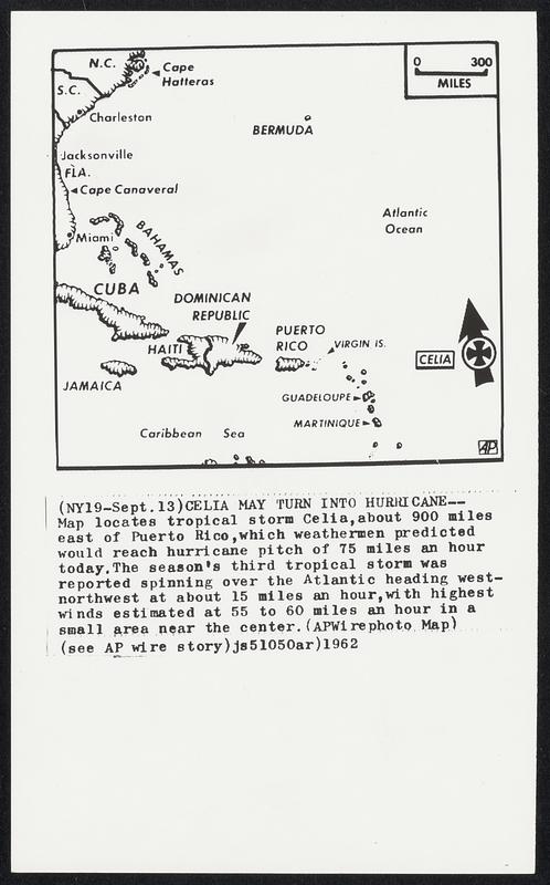
Celia May Turn into Hurricane--Map locates tropical storm Celia, about 900 miles east of Puerto Rico, which weathermen predicted would reach hurricane pitch of 75 miles an hour today. The season's third tropical storm was reported spinning over the Atlantic heading west-northwest at about 15 miles an hour, with highest winds estimated at 55 to 60 miles an hour in a small area near the center.
Associated Press · [ca. September 1962]
[Information from item housing] Weather: Hurricane: Maps: Wire Photos
🔒
Order museum-quality prints
Sign in to order prints, canvas, and more of this work. Browsing and full-resolution downloads stay free.