Digital Commonwealth — Boston Public Library
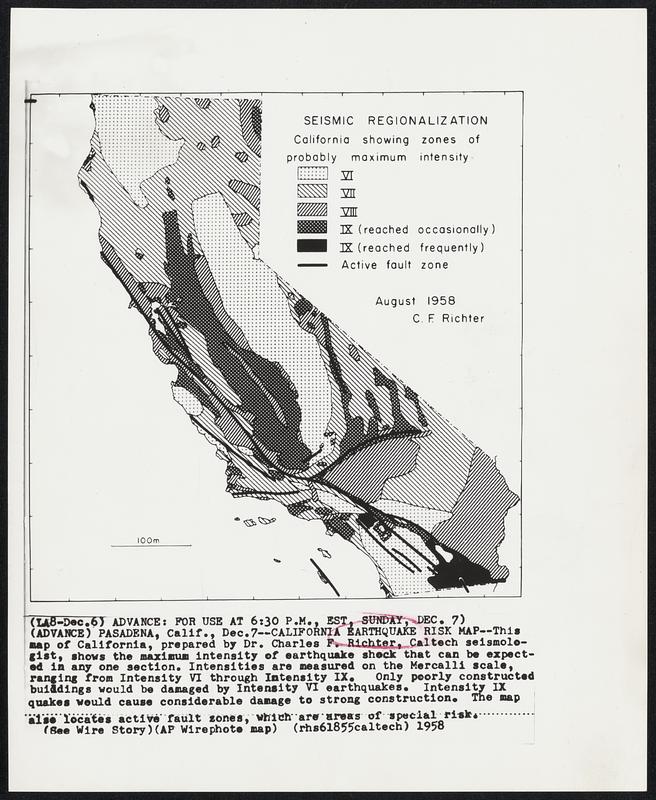
California Earthquake Risk Map -- This map of California, prepared by Dr. Charles F. Richter, Caltech seismologist, shows the maximum intensity of earthquake shock that can be expected in any one section. Intensities are measured on the Mercalli scale, ranging from Intensity VI through Intensity IX. Only poorly constructed buildings would be damaged by Intensity VI earthquakes. Intensity IX quakes would cause considerable damage to strong construction. The map also locates active fault zones, which are areas of special risk.
Associated Press · [ca. December 1958]
[Information from item housing] Earthquakes Misc.
🔒
Order museum-quality prints
Sign in to order prints, canvas, and more of this work. Browsing and full-resolution downloads stay free.