Digital Commonwealth — Boston Public Library
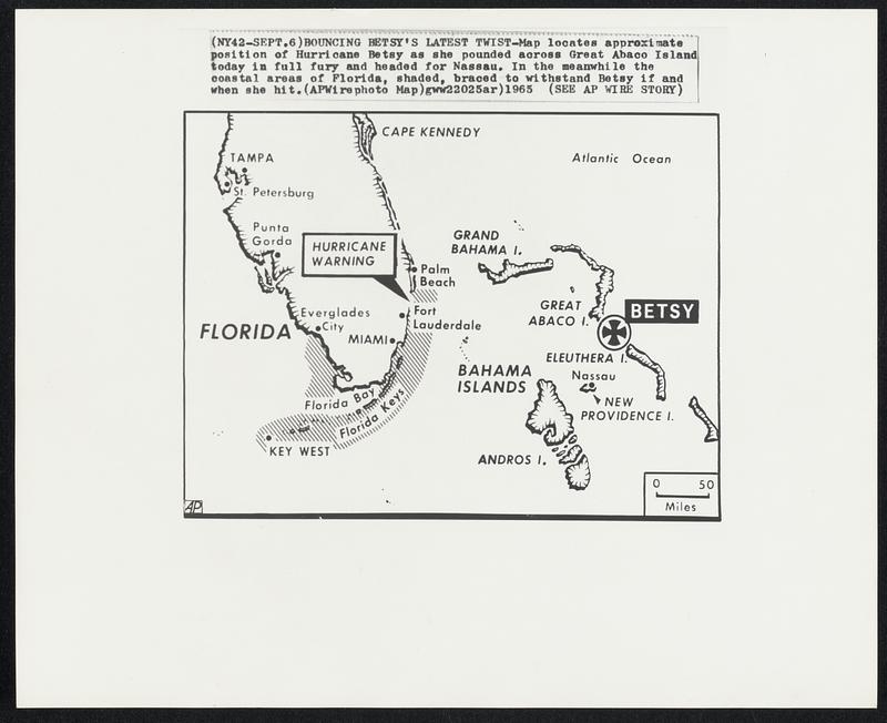
Bouncing Betsy’s Latest Twist -- Map locates approximate position of Hurricane Betsy as she pounded across Great Abaco Island today in full fury and headed for Nassau. In the meanwhile the coastal areas of Florida, shaded, braced to withstand Betsy if and when she hit.
Associated Press · [ca. September 1965]
[Information from item housing] Weather: Hurricane: Maps: Wire Photos
🔒
Order museum-quality prints
Sign in to order prints, canvas, and more of this work. Browsing and full-resolution downloads stay free.