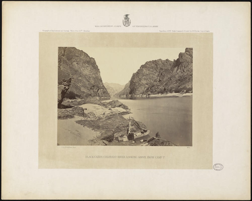
Black Cañon, Colorado River, looking above, from Camp 7
O'Sullivan, Timothy H., 1840-1882 · [1871]
Descriptive legend of view no. 2: The Black Cañon is the most southerly of the great water-gaps for which the Colorado River is celebrated. Here the stream winds for thirty miles through mountains of hard rock, following a channel whose boundary walls vary in height from 1,000 to 1,500 feet. These cliffs, which are too steep to be scaled, rise abruptly from the margin of the river, along whose shores it is hard to find a nook of beach commodious enough for the explorer's camp. The Cañon takes its name from the sombre shadows which are perpetual in its depths, and from the dark color of its volcanic rock, whose igneous origin is indicated by the irregularity of the masses in which it is piled. Numerous rapids and sunken rocks render the Cañon practically impassable for boats and the foot of this gorge may be considered the upper limit of economical navigation on the Colorado River. At this point the exploring steamer of Lieutenant Ives was wrecked in 1858, causing the abandonment of his researches in this direction. As an instance of the erosive power of swift rivers, it may be mentioned that the bed of the "Roaring Rapid" of the Black Cañon, which was described by Lieutenant Ives in 1858 as of a formidable acclivity, had become so graded down by the friction of the water as to make it barely distinguishable from adjacent rapids when visited by Lieutenant Wheeler in 1871.
Sign in to order prints, canvas, and more of this work. Browsing and full-resolution downloads stay free.