Digital Commonwealth — Boston Public Library
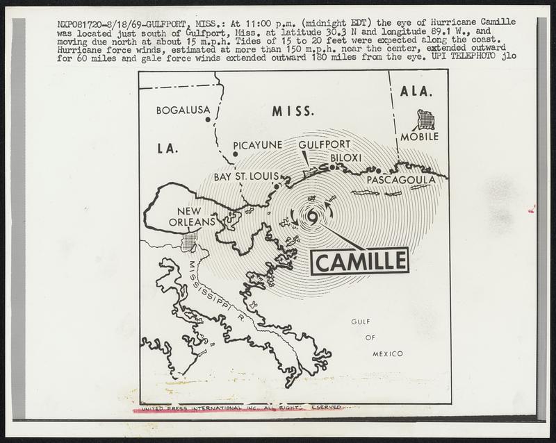
At 11:00 p.m. (midnight EDT) the eye of Hurricane Camille was located just south of Gulfport, Miss. at latitude 30.3 N and longitude 89.1 W., and moving due north at about 15 m.p.h. Tides of 15 to 20 feet were expected along the coast. Hurricane force winds, estimated at more than 150 m.p.h. near the center, extended outward for 60 miles and gale force winds extended outward 180 miles from the eye.
United Press International · [ca. August 1969]
[Information from item housing] Weather: Hurricane: Camille, Aug. 1969: Wirephotos
🔒
Order museum-quality prints
Sign in to order prints, canvas, and more of this work. Browsing and full-resolution downloads stay free.