Digital Commonwealth — Boston Public Library
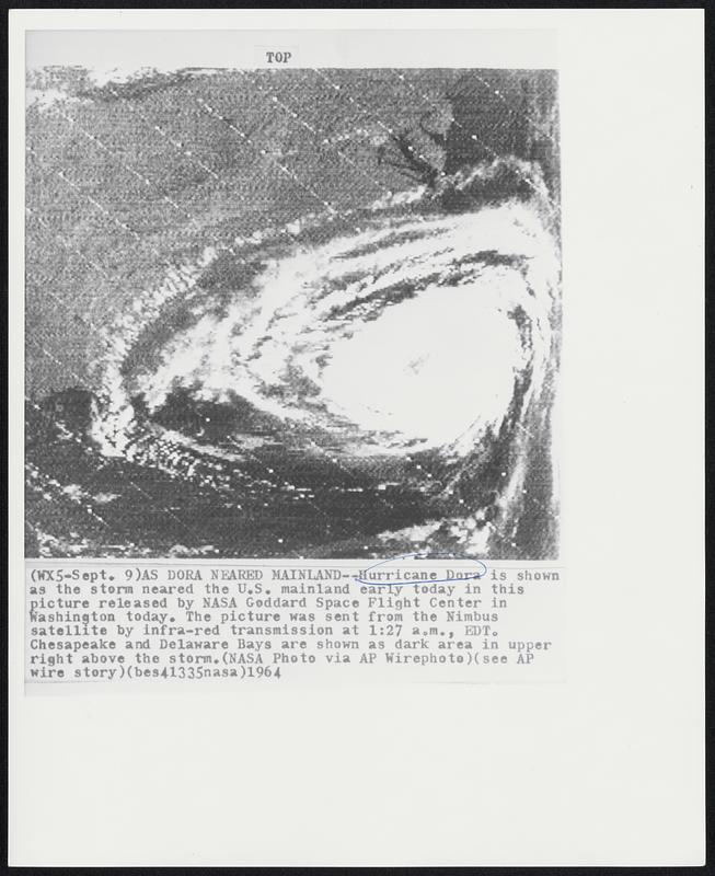
As Dora Neared Mainland--Hurricane Dora is shown as the storm neared the U.S. mainland early today in this picture released by NASA Goddard Space Flight Center in Washington today. The picture was sent from the Nimbus satellite by infra-red transmission at 1:27 a.m., EDT. Chesapeake and Delaware Bays are shown as dark area in upper right above the storm.
Associated Press · [ca. September 1964]
[Information from item housing] Weather: Hurricane: Dora, Sept. 1964: Wire Photos
🔒
Order museum-quality prints
Sign in to order prints, canvas, and more of this work. Browsing and full-resolution downloads stay free.