Digital Commonwealth — Boston Public Library
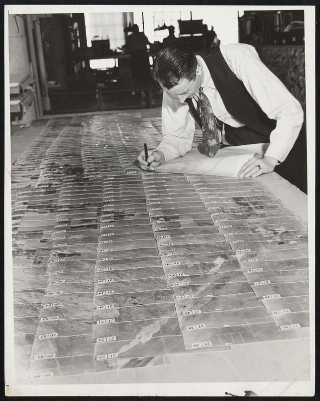
Aerial Map Making -- A Painstaking Job. Here the prints are laid out on a huge board to be matched together. Each is numbered so that it can be easily fitted into place. Note how straight the lines are. Previous to the use of the "polar navigator" it was often necessary to rephotograph many sections because the pilot had deviated so far from a straight line, that many of the photographs could not be fitted into the mosaic.
Wide World Photos, Inc. · [ca. December 1937]
[Information from item housing] Maps & Mapmaking
🔒
Order museum-quality prints
Sign in to order prints, canvas, and more of this work. Browsing and full-resolution downloads stay free.
![Carved figures from the 2d stone ratha [i.e. Arjuna Ratha] at Mahavellipooram](https://bpldcassets.blob.core.windows.net/derivatives/images/commonwealth:pv63k3948/image_thumbnail_300.jpg)