Digital Commonwealth — Boston Public Library
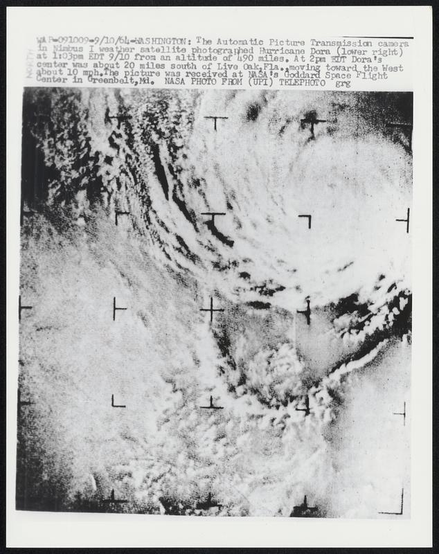
The Automatic Picture Transmission camera in Nimbus 1 weather satellite photographed Hurricane Dora (lower right) at 1:03pm EDT 9/10 from an altitude of 490 miles. At 2pm EDT Dora's center was about 20 miles south of Live Oak, Fla., moving toward the West about 10 mph. The picture was received at NASA's Goddard Space Flight Center in Greenbelt, Md.
United Press International · [ca. September 1964]
[Information from item housing] Weather: Hurricane: Dora, Sept. 1964: Wire Photos
🔒
Order museum-quality prints
Sign in to order prints, canvas, and more of this work. Browsing and full-resolution downloads stay free.