Digital Commonwealth — Boston Public Library
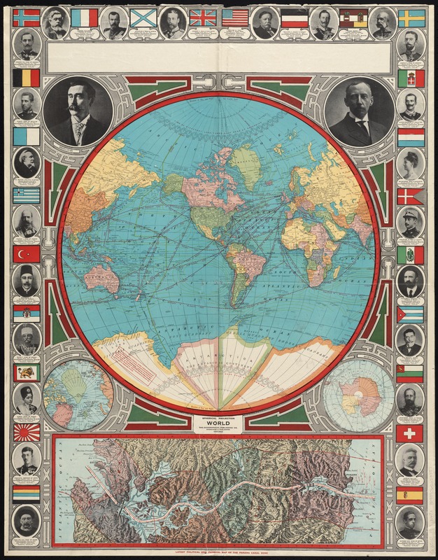
Spherical projection world
Geographical Publishing Co · [1913]
Borders, political dominance, and colonial rule: these were headline news one hundred years ago just as they are today. Blatantly imperialistic, this map was made during the political tensions before World War I to declare world powers’ land claims. In the "Spherical Projection World" map, global dominance is asserted with the images of international leaders and their flags. Explorers and commentary on polar discovery are also included, indicating there were new territories yet to be conquered.
🔒
Order museum-quality prints
Sign in to order prints, canvas, and more of this work. Browsing and full-resolution downloads stay free.