Digital Commonwealth — Boston Public Library
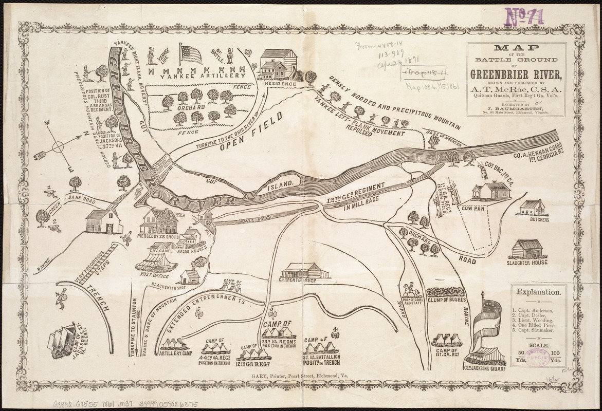
Map of the battle ground of Greenbrier River
McRae, A. T. · [1861?]
During the Civil War, daily newspapers used maps to inform their readers about the changing fortunes of an ensuing battle. Representing a Confederate viewpoint, this battle map features the strategic placement of troops, geographic topography, the position of enemy Yankee artillery, principal buildings, roads, and drainage.
🔒
Order museum-quality prints
Sign in to order prints, canvas, and more of this work. Browsing and full-resolution downloads stay free.