Digital Commonwealth — New Bedford Free Public Library
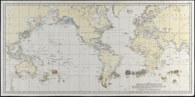
Distribution of Northern and Southern Right Whales based on logbook records dating from 1785 to 1913
Townsend, Charles Haskins, 1859-1944 · [ca. 1913–1922]
Map of the world showing the distribution of northern and southern right whales based on logbook records dating from 1785 to 1913. Each colored dot represents the position of a whaleship on a day when one or more whales were taken. Each months whaling is colored distinctly, positions represent catches of 8,415 right whales.
🔒
Order museum-quality prints
Sign in to order prints, canvas, and more of this work. Browsing and full-resolution downloads stay free.